top of page

Mount Mulligan - Ngarrabullgan

Outside World Heritage Area.

National Heritage List 2011.


 Name of Protectected Area: Ngarrabullgan              


                                                (National Heritage List 2011)  


Indigenous Name:                Ngarrabullgan


Name of Mountain Range:   Featherbed  Range


Height Above Sea Level:        Highest Point 814 m


Scroll

Down &

Click on

an Image

Northern cliff line Mt Mulligan

Northern cliff line Mt Mulligan

The tabletop mountain is a monolith bounded by high cliffs (or escarpments) that fall 200 to 400m to the surrounding Hodgkinson Basin

Sandsotne Cliffs - Mt Mulligan

Sandsotne Cliffs - Mt Mulligan

On the table top itself are found the two oldest known Aboriginal sites in Queensland: Nonda Rock and Ngarrabullgan Cave. Here Aboriginal cultural deposits have been radiocarbon dated, and dated by optically stimulated luminescence (OSL), back to 40,000+ years ago.

Cliff Detail Mt Mulligan

Cliff Detail Mt Mulligan

The mountain was originally formed in a narrow faulted rift (running in a general south-east to north-west direction) within the deformed and folded metamorphic rock (arenite) of the Hodgkinson Basin.

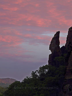
Setting Sun on Cliff Mt Mulligan

Setting Sun on Cliff Mt Mulligan

Successive layers of sediment were deposited into this rift, filling it first with Permian coal (at its base), then Permian conglomerates, with Triassic sandstones above. With tectonic uplift, the original arenite surrounding the deposits eroded away leaving Ngarrabullgan as a free-standing conglomerate and sandstone massif.

TSR Watermark - 0345.jpg

TSR Watermark - 0345.jpg

The combination of impressive natural feature, Aboriginal beliefs and mythologies and archaeological sites of such antiquity make Ngarrabullgan the oldest known and dated cultural landscape in Queensland, and a place of state, national and international interest and scientific significance

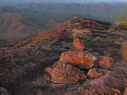
Eroded Sandstone -  Mt Mulligan

Eroded Sandstone - Mt Mulligan

Water, wind and heat working together for eons have formed enigmatic landforms; Mt Mulligan is a living landscape.

Mt Mulligan at Dawn

Mt Mulligan at Dawn

In the background lies the ghost town of Thornsborough, one of the centres for the Hodgkinson Goldfields. Alluvial gold mining commenced in 1876 and lode (reef) mining in 1877. More then 9.8+ tonnes of gold bullion were produced from the field. Of the 9.8 tons, only 1.3 was alluvial gold while 115 km north west in the Palmer River Goldfield the 46 + ton of gold mined there was primarily alluvial.

Hidden Waterhole Mt Mulligan.

Hidden Waterhole Mt Mulligan.

Water was key to the survival of the aboriginal people. Water holes like this held water all year round.

Turkey Bush Calytrix spp.

Turkey Bush Calytrix spp.

This Calytrix has developed a bonsai like style, growing in this extreme environment of solid rock, seasonal rain and high heat.

Sunrise over  Mt Mulligan

Sunrise over Mt Mulligan

Valley Mt Mulligan

Valley Mt Mulligan

Aboriginal people used this landscape for 40 000 years +- . They are present still in this landscape.

Sheer Sandstone Cliff Mt Mulligan

Sheer Sandstone Cliff Mt Mulligan

Spectacular cliffs are formed because the Mt Mulligan coal measures are overlain by conglomerate and sandstone of the Pepper Pot Sandstone from the Triassic period.

Hodgkinsom Goldfield - Mt Mulligan

Hodgkinsom Goldfield - Mt Mulligan

The conglomerate rocks contain unsorted, rounded to sub rounded to well rounded small boulders of quartz, quartzite, chert, jasper and arenite.

Water Hole Mt Mulligan

Water Hole Mt Mulligan

Deep within the eroded gorges of Mt Mulligan, water is found all year round.

Mt Mulligan Flutes

Mt Mulligan Flutes

The presence of plant fossils, conglomerate lenses and pebbly sandstone delineating stream channels, washouts and coarse torrential bedding, indicate a deposition by flooding events 205-245 millions years ago.

Mt Mulligan to Windsor Tablelands

Mt Mulligan to Windsor Tablelands

At sunset a large part of the Hodgkinson Goldfield stretching out to the Desailli Range (left), Windsor Tableland (middle) and Carbine Tableland (right) can be seen. The Hodgkinson River (foreground) and Mitchell River (background) exist within this panorama.

bottom of page